The Rock Beneath Our Feet: Geology, Recreation, and Stewardship at Cherokee Rock Village

Andrew Bieber • August 16, 2026

Share this article

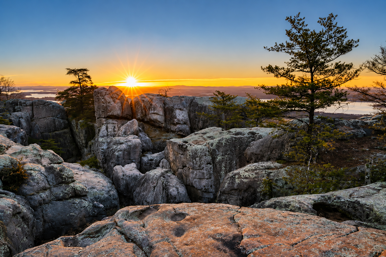
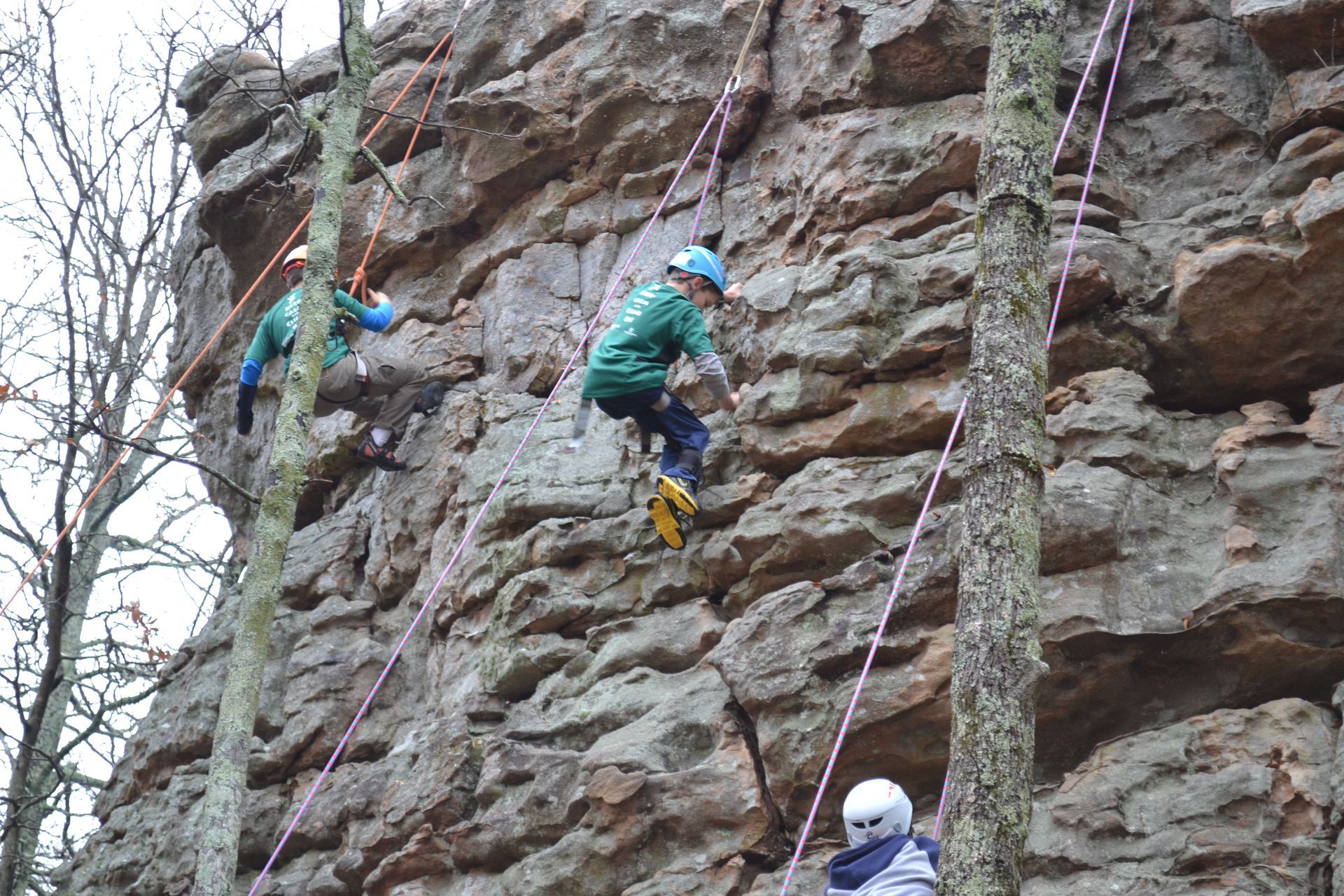
  Walk through Cherokee Rock Village and the geology is impossible to separate from the experience of the park. Massive sandstone formations rise near the summit. Narrow corridors wind between towering rock faces. Climbers follow cracks and features up the stone, while hikers, campers and visitors move through the spaces between the formations. The rock is what makes Cherokee Rock Village what it is.


Across much of the summit, sandstone lies close beneath the surface. The soil that supports grasses, wildflowers, shrubs and trees can be relatively thin, including many of the same areas where people camp, climb, hike, and gather. These natural features and recreational uses exist together, and understanding that relationship is an important part of caring for Cherokee Rock Village. In heavily used areas, normal wear can thin vegetation and expose the ground beneath it. Where soil was already shallow, there may be little available to lose before bedrock begins to show through. The same geology that created the formations people come here to experience also helps determine how water moves across the landscape, where soil can accumulate, where plants can grow, and how much disturbance some areas can withstand. To understand why some parts of this landscape can be especially sensitive to change, we must look to the rock beneath our feet.


From Sand To Stone

  The sandstone that forms Cherokee Rock Village preserves a chapter of geologic history dating back more than 300 million years. Geologists identify these rocks as part of the Pottsville Formation, a widespread sequence of sandstone, shale and other sedimentary rocks formed during a span of Earth's history known as the Pennsylvanian Period, roughly 323 to 299 million years ago.


At that time, the world looked very different. Continents were moving toward one another, and the Appalachian Mountains were being shaped by a series of mountain-building events that unfolded over hundreds of millions of years. As mountains were uplifted and older rocks were exposed to weathering and erosion, enormous quantities of sand, gravel and mud accumulated in basins along the developing Appalachian mountain belt. Layer after layer of this sediment was deposited and buried. Over immense spans of time, pressure and natural mineral cements bound the loose grains together, turning sediment into sedimentary rock. Some of the evidence for that ancient environment is still visible in the sandstone at Cherokee Rock Village.


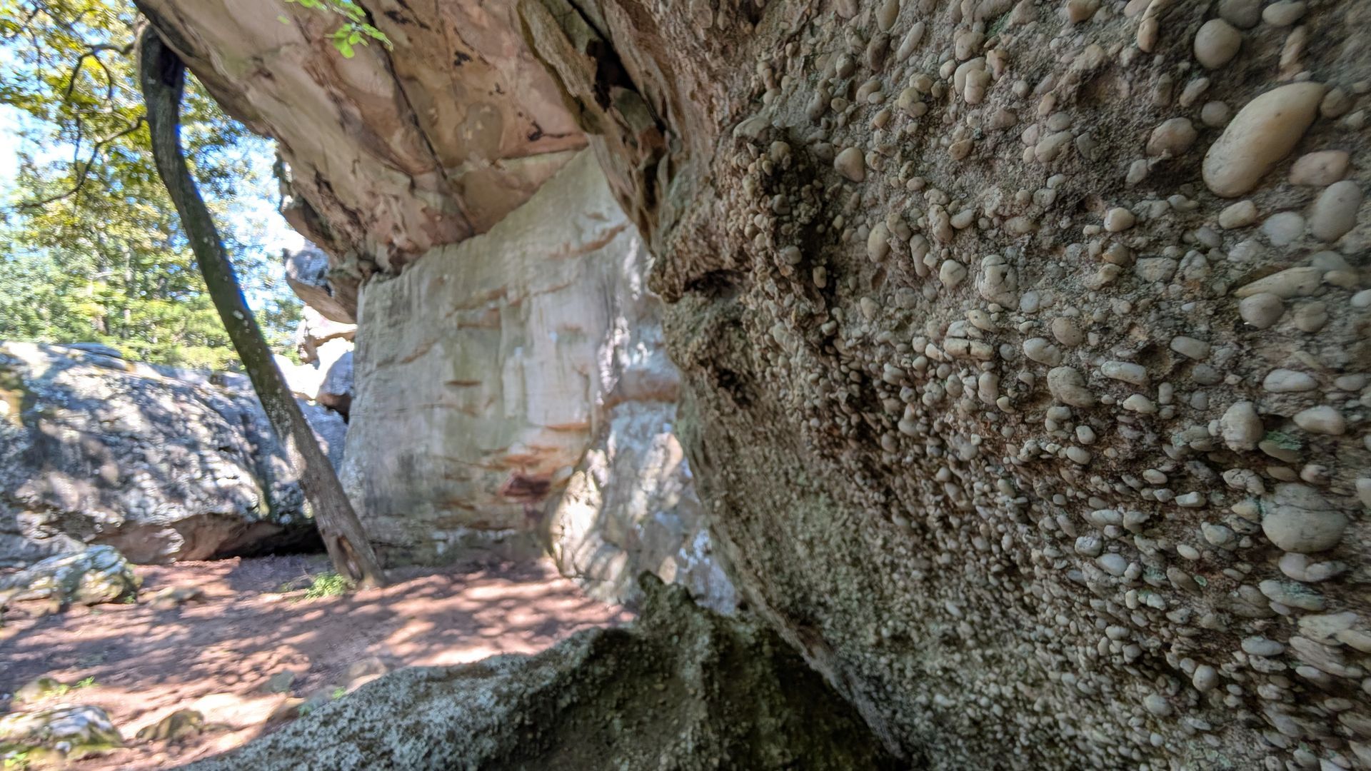
Look closely and you can find small, rounded pebbles embedded directly within the rock. These pebbles were once loose rock fragments carried by moving water and deposited among the sand that surrounded them. As those sediments were buried, compacted and cemented together, the pebbles became part of the sandstone we see today. Their presence is also a characteristic geologists use to help identify the Pottsville Formation and distinguish it from some of the rock layers below it. Elsewhere, layers sweep diagonally through the sandstone instead of lying flat. Geologists call these structures cross-beds. They formed as moving water pushed sand and pebbles along underwater ripples and dunes, leaving sloping layers behind as sediment accumulated.


Today, those features are preserved in solid rock. The pebbles and cross-beds visible throughout the park are clues to a landscape shaped by moving water and sediment more than 300 million years ago. What now appears to be a motionless wall of stone still preserves evidence of sediment in motion.

Shaping The Rock Village

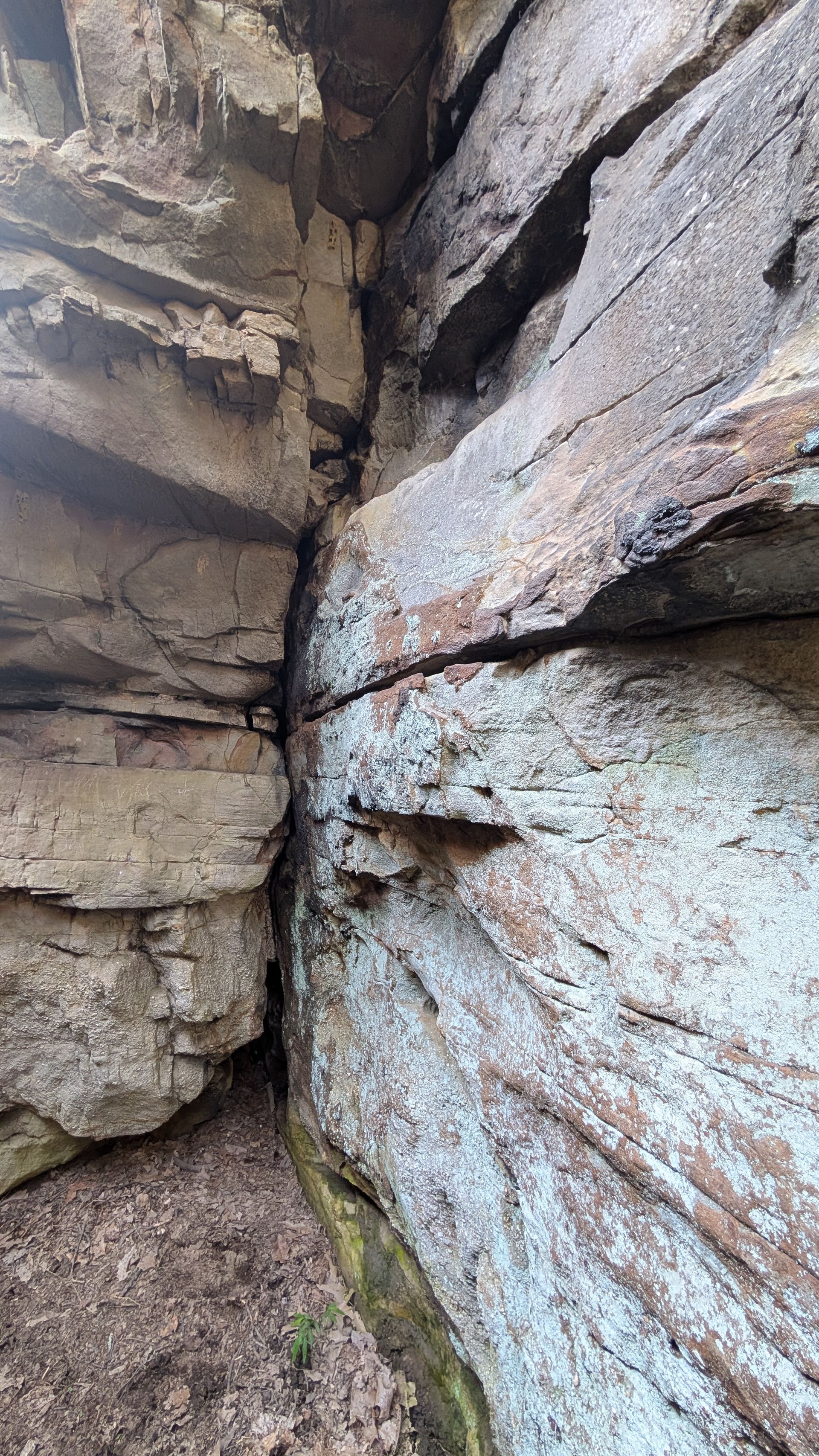
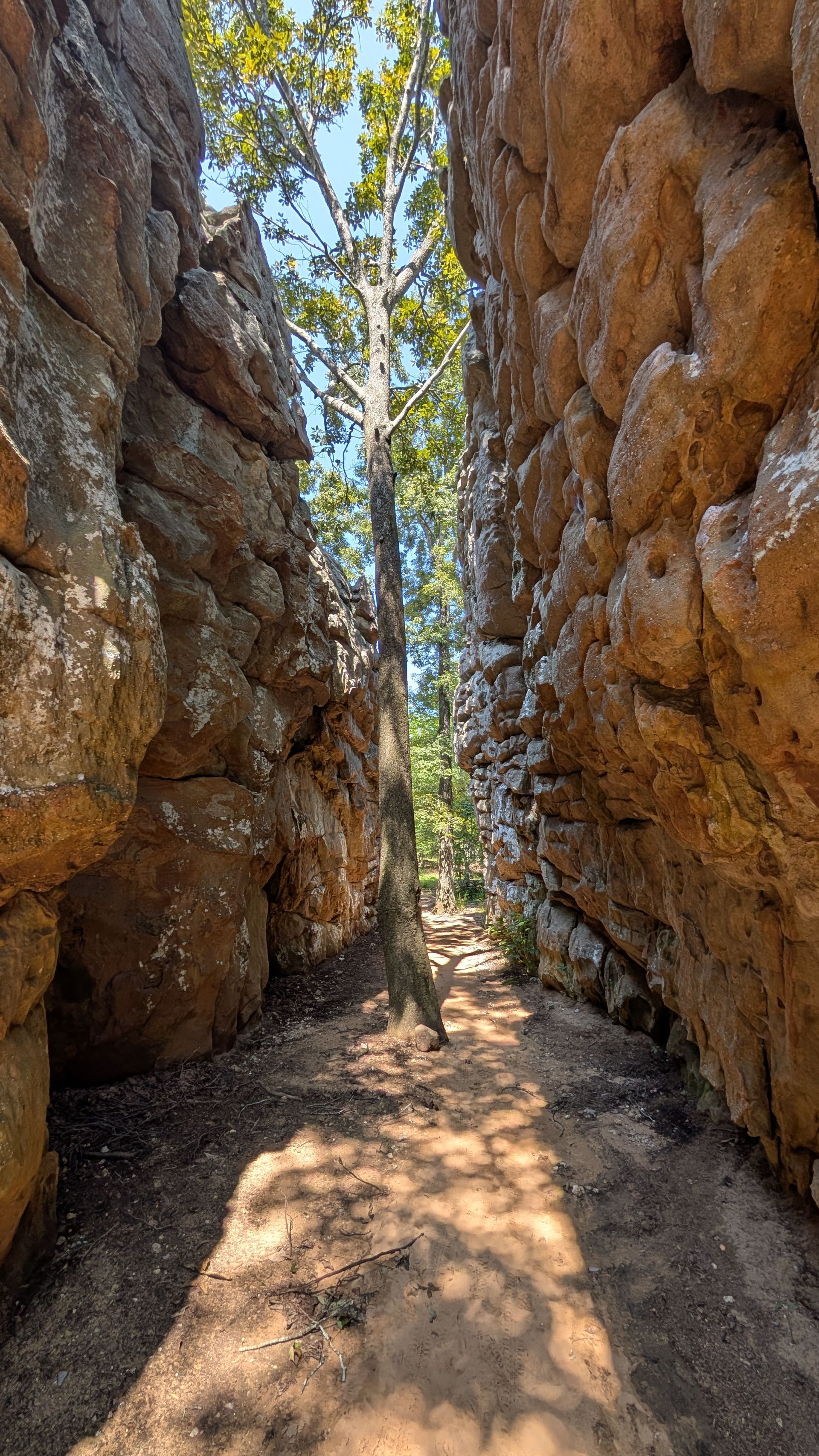
At some point in the rock's long history, fractures developed through the sandstone. Geologists call fractures like these joints. Unlike a fault, a joint does not require significant movement of the rock on either side. It is simply a break that creates a weakness within an otherwise solid mass of stone. Those weaknesses became important once weathering and erosion began working on the exposed sandstone. Water entered the fractures, allowing weathering to work along the newly exposed surfaces. Over time, material was gradually removed, fractures widened and large sections of sandstone became increasingly separated from one another. Some of the enormous passages visitors walk through today follow these joints.


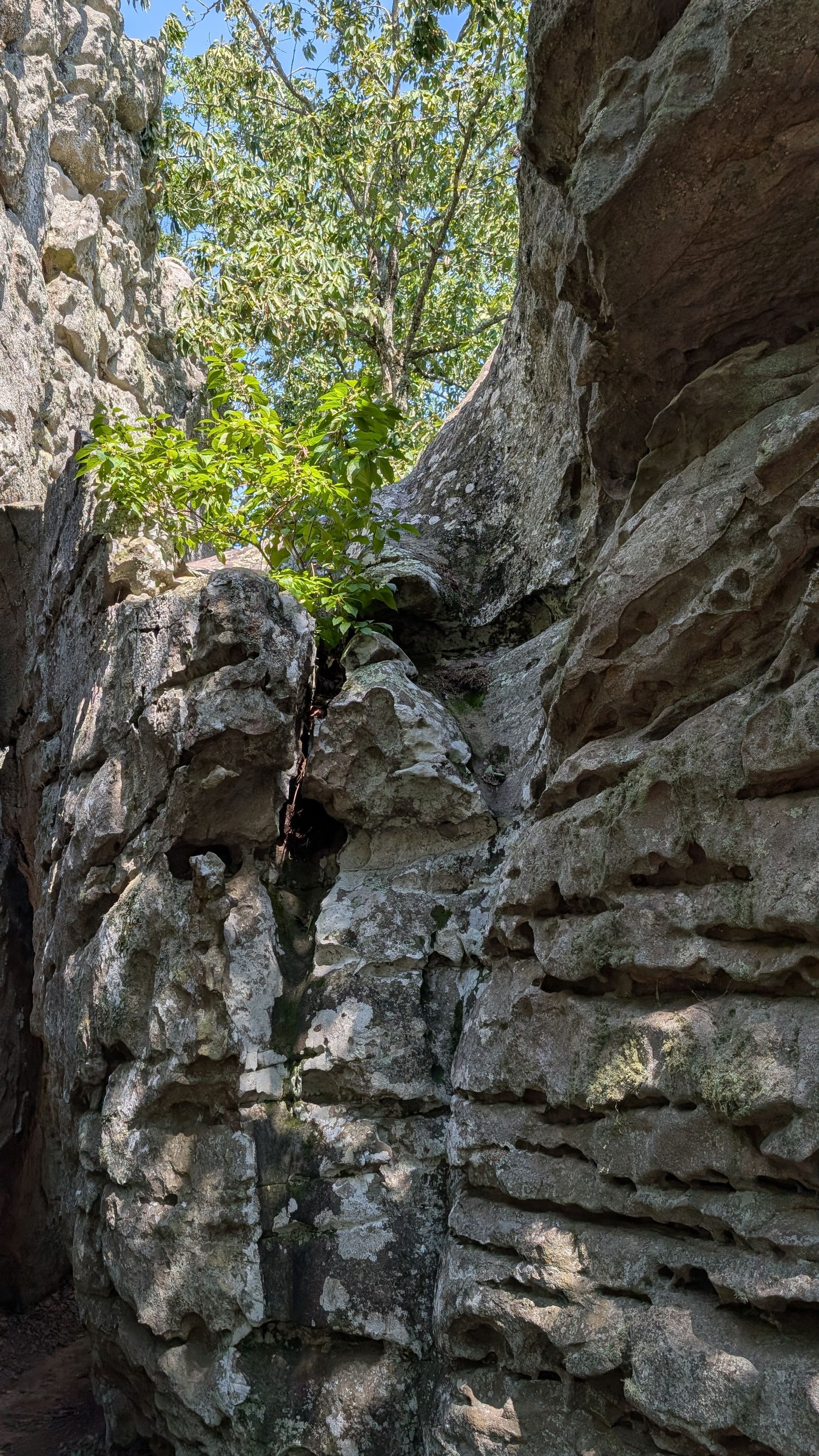
In other places, blocks broke away or shifted downslope along existing fractures. The result is the landscape that gives Cherokee Rock Village its name: tall rock faces, isolated blocks, narrow corridors, overhangs and seemingly endless spaces between the sandstone. The Rock Village was not simply carved randomly from one enormous mass of stone. The fractures already present within the sandstone helped provide the blueprint. Weathering, erosion and gravity worked along those weaknesses over immense spans of time.


Those processes have never stopped. They continue to shape not only the sandstone itself, but the soil, vegetation, and pathways between the formations.

A Thin Layer Between Rock and Life

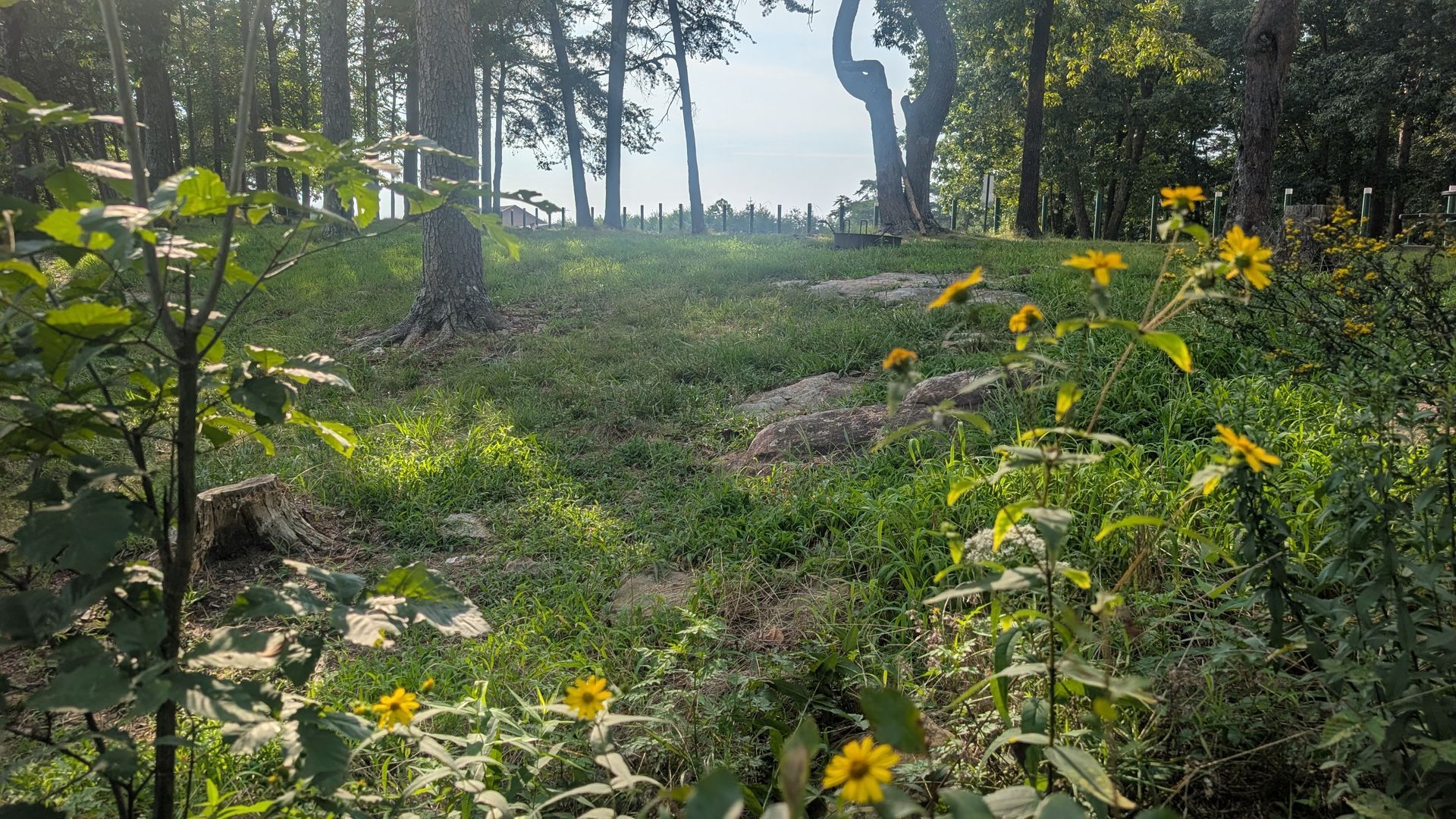
  The sandstone formations naturally command our attention, but the landscape between them is just as important. Throughout much of Cherokee Rock Village, vegetation grows within relatively thin and uneven layers of soil over and between the sandstone. That limited soil supports grasses, wildflowers, shrubs and trees, whose roots and protective cover in turn help keep it in place.


These same areas also support much of the recreation the park was created to provide. The campground occupies the summit, the Rock Village extending below its southern edge, while trails and climbing areas continue throughout the formations. With that use comes the normal wear of an active recreational landscape. In some of the most heavily used areas, vegetation becomes thinner and soil is exposed, creating places where thoughtful maintenance becomes especially important.


The position of the campground helps illustrate why. Several campsites along its southern edge slope toward the Rock Village below. During heavy rainfall, exposed soil can move downslope and collect at the bases of the sandstone formations. The rock faces themselves add to that runoff. Rainfall moves across the exposed sandstone and reaches the ground below, where it can pick up loose sediment and carry it farther downslope. What begins as soil loss in one area can therefore become part of a larger pathway of erosion throughout the park’s landscape.


Over time, that loss can become self-reinforcing. Less vegetation means less protection for the soil that remains. As more soil disappears, roots and uneven bedrock become exposed, vegetation becomes harder to maintain, and recreational areas can become increasingly rough and difficult to navigate.


The geology that makes recreation special at Cherokee Rock Village also makes thoughtful stewardship of that recreational landscape especially important. Protecting the soil and vegetation between the formations is not only a conservation concern, it is part of protecting the accessible areas that allow people to experience the park in the first place.

Caring For A Changing Landscape

  The geologic story of Cherokee Rock Village did not end when the sandstone walls and passages took shape. Weathering, erosion, water and gravity are the same forces that helped shape these formations over immense spans of time, and they are still at work today. Every rainfall continues that process, moving water across the sandstone, through its fractures and over the soil that has accumulated between the rocks. Our role is not to stop that natural change, it is to recognize where our use of the landscape can accelerate it. For visitors, understanding these processes can help inform how we experience the park. This is a place to camp, climb, hike, and explore. It is thoughtful choices that can help keep those opportunities sustainable.


Staying on established trails and climbing approaches helps keep foot traffic concentrated on routes intended for repeated use. Around campsites and climbing areas, keeping activity within established use areas gives surrounding vegetation a better chance to remain intact. Avoiding shortcuts, particularly on slopes, helps prevent new paths from becoming channels for both footsteps and stormwater. When an area is closed or marked for rehabilitation, giving it time to recover allows vegetation to become established and begin holding the soil in place again.


Even the smallest patches of vegetation can be important in a landscape built on sandstone. A strip of grass beside a campsite, plants growing between two formations, or vegetation along a climbing approach may occupy only a thin layer of soil. Once that soil is lost, the sandstone beneath it becomes part of the exposed surface, and a change that occurred naturally over geological time can be accelerated within the places we use most.


That difference in timescale is important. More than 300 million years of deposition, mountain building, fracturing, weathering and erosion helped shape the Cherokee Rock Village we experience today. The cross-beds and pebbles preserved within the sandstone tell us where that rock began, while the joints, passages and towering faces show us what happened as it was fractured, exposed and weathered over time. Those processes gave us the cliffs we climb, the passages we explore, and the landscape we come here to enjoy. They also remind us that the park is not a finished place. It is still changing.


Our part of that history will be much shorter.


Being a good steward of Cherokee Rock Village does not mean leaving it untouched. It means understanding the landscape, recognizing its limits, and enjoying it in a way that allows others to experience it long into the future.


This park has been shaped over hundreds of millions of years. Our responsibility is to leave future generations the opportunity to experience what we are fortunate enough to enjoy today.

Continued Learning

Want to dig a little deeper? These resources explore the geologic history of Alabama and the southern Appalachians, from the ancient processes that shaped the landscape to the relationship between geology, recreation, and erosion at Cherokee Rock Village today.

Recent Posts

By Andrew Bieber and Ella Alford July 31, 2026
If you live in northeastern Alabama, you know how quickly spring can turn into summer. In spring, the landscape seems to wake up almost overnight. Grasses turn green, wildflowers begin blooming and new growth appears across the region. By June, the heat and humidity have settled in, and that gentle spring growth is facing a much tougher season. Summer rain here does not always arrive slowly. It often comes from isolated thunderstorms that drop a great deal of water in a short amount of time. At Cherokee Rock Village, that water can rush across sloping ground and thin, rocky soil before it has time to soak in. On the heavily used summit where the park’s campground resides, heavy rain carries exposed soil away and gradually carves pathways into the ground. With each storm, those pathways can grow deeper, allowing water to move faster down the mountain and cause further erosion around hiking trails, climbing areas and the surrounding landscape.  As we wrapped up the spring season, we paused mowing wherever naturally occurring native plants were growing, including throughout our camping areas. This gave native grasses and wildflowers time to mature, flower and form seed. As we move into August, we are beginning the next stage of our selective summer mowing practices. Using mowers and weed trimmers, we cut only the upper few inches of the vegetation, helping scatter mature seed while leaving as much growth standing as possible. This makes the camping areas more usable while maintaining the groundcover needed to protect the soil during the hottest part of the year.